

IDDS UCiP: Locate Emergency Callers Safely
Unlock the Power of Location Tracking and Data Retrieval with IDDS UCiP
Every day, reports and news broadcasts provide information about current operations. You may have already come across the following message: “The missing person was located in the exposed mountain region with the help of a smartphone.”
How Does Our Digital Positioning Work?
Our system leverages mobile operator data, utilizing the geographic positions of cellular base stations (BTS) and their radio coverage areas. This information is invaluable for law enforcement and, more importantly, in the case of critical rescue missions. Austrian control centers have legal access to this sensitive data, which is automatically retrieved for emergency calls from both mobile and landline networks. We call this the RTR (Rundfunk und Telekom Regulierungs-GmbH) interface. It is compliant with the Telecommunications Act and will be available for customers beginning with system release 1.28.
The RTR interface not only offers location data but also provides valuable additional information, including the subscriber‘s name and address. With the IDDS UCiP, we seamlessly integrate the RTR interface into our system, ensuring that this information is readily available.
IDDS UCiP: Where Location and Master Data Meet
When an emergency call is made, our IDDS UCiP system instantly queries location and master data, delivering critical information within seconds. Users can access this data via a map or text display, ensuring they have the information they need when it matters most. For landline numbers, the subscriber‘s address is provided instead of a terminal position.
In addition to the automatic query feature, there is also an option for manual queries. Users can request location and master data associated with a phone number at any time, independently of phone calls. However, this manual query option is reserved for emergency situations only, with the user making the determination of what constitutes an emergency. The IDDS UCiP system provides support by offering relevant information and evaluation tools to assist in the decision making.
Enhancing Precision with AML and RTR
The data obtained from the location and master data query complements AML (Advanced Mobile Location) perfectly. While AML provides highly accurate positioning for mobile network emergency calls, the RTR interface offers valuable additional details such as addresses and names. Importantly, the RTR interface extends its support to calls from landline networks, making it an indispensable tool for emergency services.
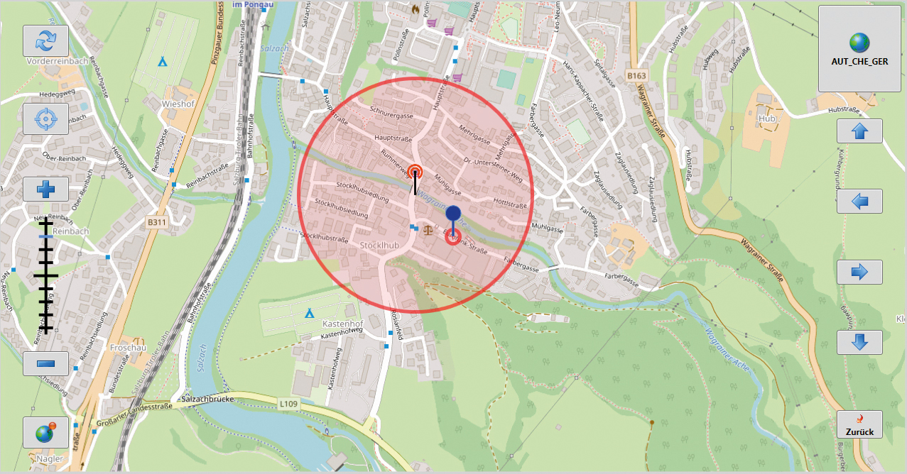
Overlay of the subscriber location determined by AML (blue PIN in the center compared to small area of uncertainty) with RTR location
(red PIN with significantly larger area of uncertainty) in the IDDS UCiP map view. © eurofunk; Map: OpenStreetMap