
![]()
![]() 〉 Products 〉 Command and Control 〉
〉 Products 〉 Command and Control 〉

![]()
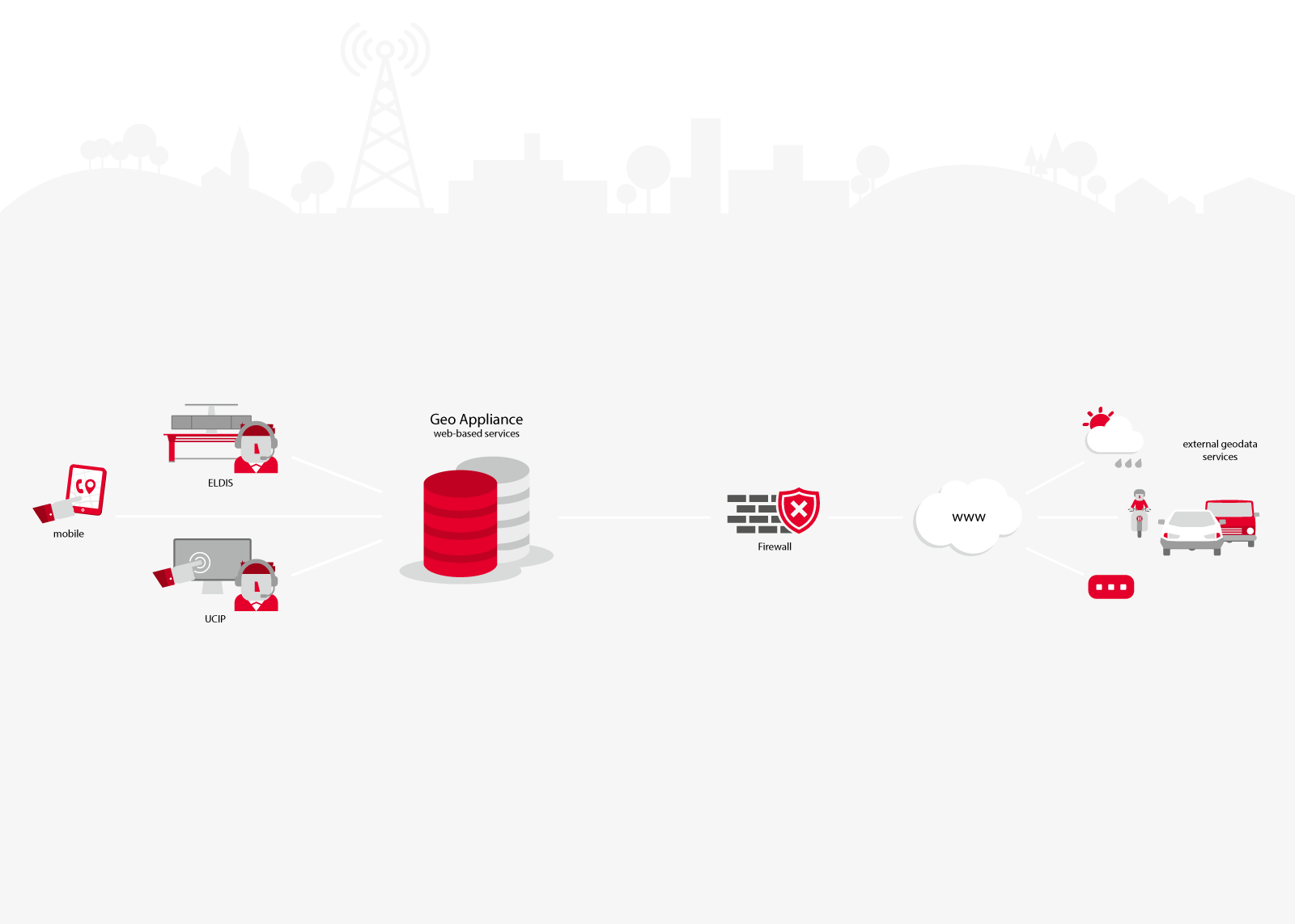
As control centers continue to centralize, the detailed local knowledge of experienced dispatchers is increasingly lost. At the same time, geographic information is becoming ever more crucial to effective incident management. The eurofunk GEO Appliance addresses this challenge by delivering consistent geodata in real time – providing a powerful, centralized solution that enables informed, data-driven decision-making in critical situations.

This system combines specialized software and hardware components and provides a wide range of graphical and geodata formats from various sources – made available in real time for GIS applications within the incident management system. The result: a complete and up-to-date operational picture for both emergency responders and dispatchers.
The scalable IT infrastructure is available in multiple expansion stages – from a single server setup to a fully redundant high-availability system. Storage capacity, backup strategies, and system integration are tailored to your requirements and can be seamlessly integrated into existing environments and fault notification systems
In emergencies, every second counts. As a standalone server instance with an integrated toolchain, the solution automatically processes a wide variety of data sources. This data is standardized and made available in real time. To ensure an accurate and up-to-date operational picture at all times, OpenStreetMap data is also included.
Fully compatible with the control and management systems ELDIS 3 and eOCS, the GEO Appliance integrates without the need for complex customization. It ensures that all relevant geographic data are available quickly and reliably—providing a solid foundation for coordinated and effective incident response.
An emergency call comes in – and within seconds, the dispatcher knows exactly where the caller is located. In the communications system, incoming emergency calls are displayed directly on a map. With eAML, eurofunk provides a dedicated interface that retrieves AML (Advanced Mobile Location) data from the national AML endpoint and visualizes it on a map. For eCall-based emergency calls, location details such as direction, last known positions, or cell towers are already available during the call. The required map data is automatically integrated.


![]()
![]()
![]()
![]()
![]()
![]()
![]()
![]()
![]()
![]()